File:Aurora borealis2, Churchill, MB.JPG
Original file (4,000 × 3,000 pixels, file size: 1.86 MB, MIME type: image/jpeg)
This file is from Wikimedia Commons and may be used by other projects. The description on its file description page there is shown below.
Summary
| DescriptionAurora borealis2, Churchill, MB.JPG |
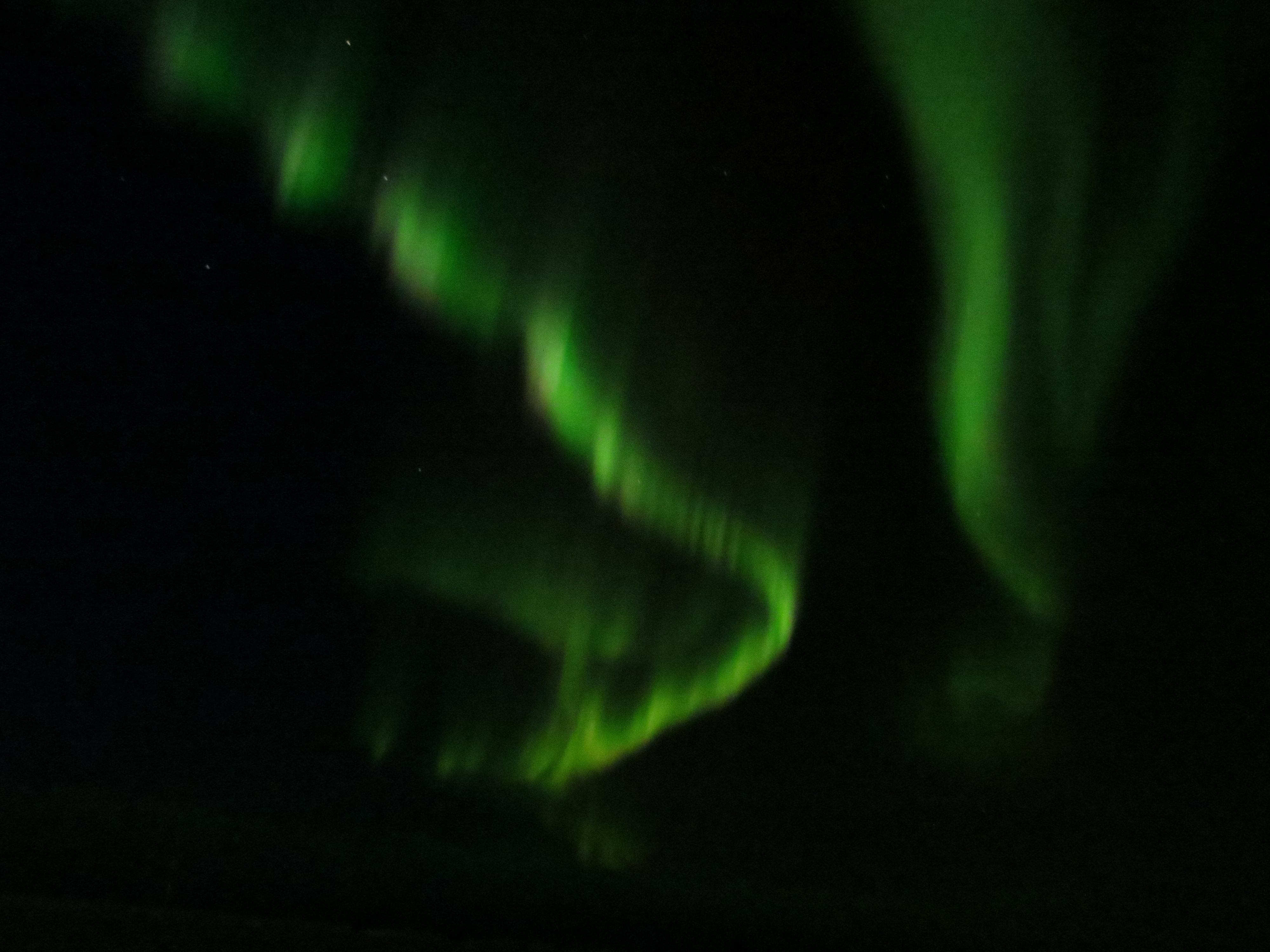
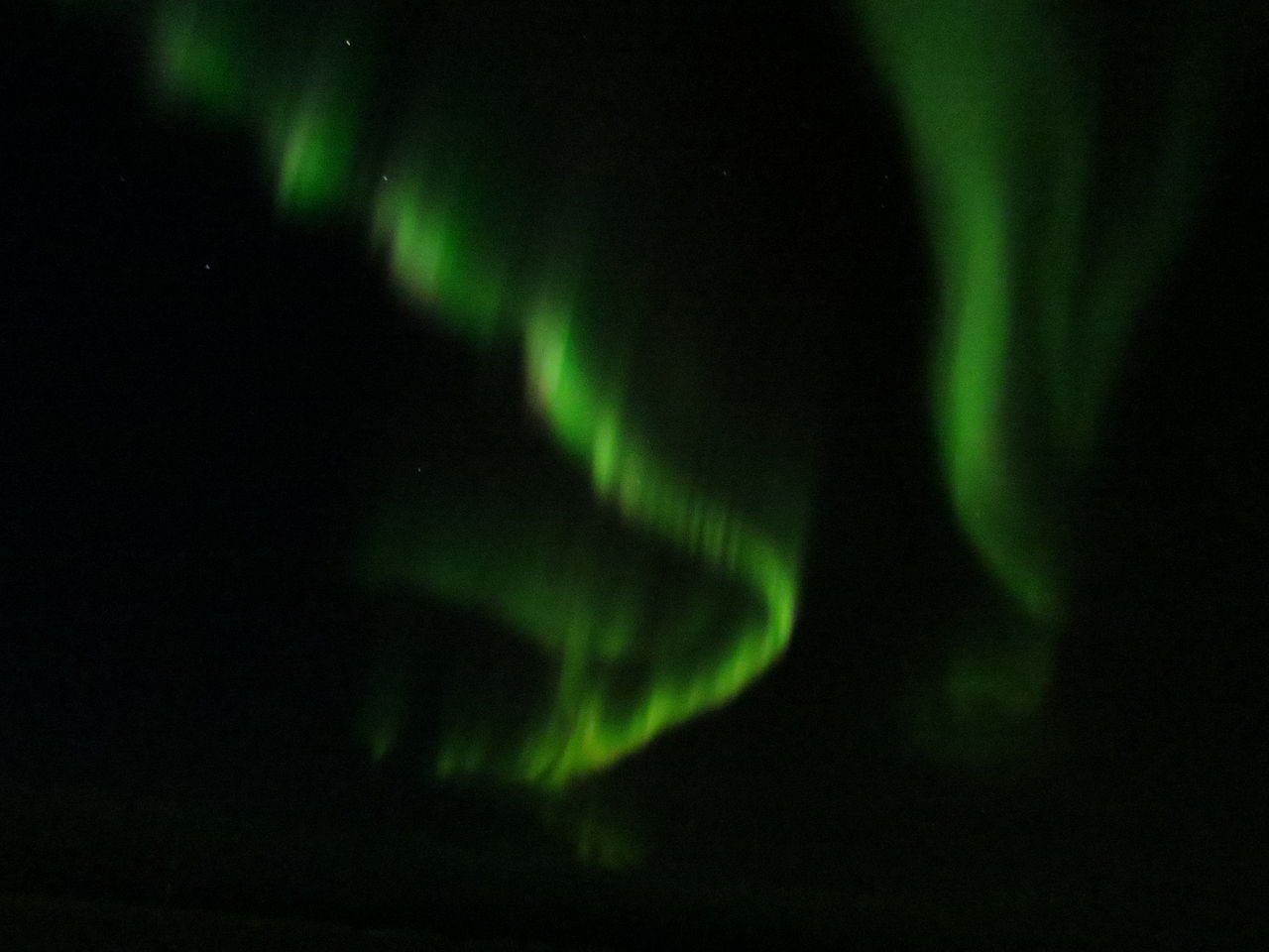
English: Aurora Borealis viewed during a geomagnetic storm, viewed east of Churchill, Manitoba near the shore of Hudson Bay |
||
| Date | |||
| Source | Own work | ||
| Author | anonymous donor | ||
| Permission (Reusing this file) |
|
| Camera location | 58° 45′ 34.8″ N, 93° 56′ 48.51″ W | View this and other nearby images on: OpenStreetMap |
|---|
Licensing
| Public domainPublic domainfalsefalse |
| This work has been released into the public domain by its author, anonymous. This applies worldwide. In some countries this may not be legally possible; if so: anonymous grants anyone the right to use this work for any purpose, without any conditions, unless such conditions are required by law. Public domainPublic domainfalsefalse |
Captions
13 November 2012
58°45'34.80001"N, 93°56'48.50999"W
image/jpeg
ae7c71f74abe033ed98531de945201d2d0bf4222
1,951,430 byte
3,000 pixel
4,000 pixel
1 second
3,200
6.497 millimetre
File history
Click on a date/time to view the file as it appeared at that time.
| Date/Time | Thumbnail | Dimensions | User | Comment | |
|---|---|---|---|---|---|
| current | 11:33, 2 April 2013 | 4,000 × 3,000 (1.86 MB) | wikimediacommons>Peterfitzgerald | User created page with UploadWizard |
File usage
The following page uses this file:
Metadata
This file contains additional information, probably added from the digital camera or scanner used to create or digitise it.
If the file has been modified from its original state, some details may not fully reflect the modified file.
| Camera manufacturer | Canon |
|---|---|
| Camera model | Canon PowerShot SX260 HS |
| Exposure time | 1/1 sec (1) |
| F Number | f/4 |
| ISO speed rating | 3,200 |
| Date and time of data generation | 23:26, 13 November 2012 |
| Lens focal length | 6.497 mm |
| Latitude | 58° 45′ 34.8″ N |
| Longitude | 93° 56′ 48.51″ W |
| Altitude | 15.5 metres above sea level |
| Orientation | Normal |
| Horizontal resolution | 180 dpi |
| Vertical resolution | 180 dpi |
| File change date and time | 23:26, 13 November 2012 |
| Y and C positioning | Co-sited |
| Exif version | 2.3 |
| Date and time of digitising | 23:26, 13 November 2012 |
| Meaning of each component |
|
| Image compression mode | 3 |
| APEX shutter speed | 0 |
| APEX aperture | 4 |
| APEX exposure bias | 0 |
| Maximum land aperture | 4 APEX (f/4) |
| Metering mode | Pattern |
| Flash | Flash did not fire, compulsory flash suppression |
| Supported Flashpix version | 1 |
| Colour space | sRGB |
| Focal plane X resolution | 16,393.442622951 |
| Focal plane Y resolution | 16,393.442622951 |
| Focal plane resolution unit | inches |
| Sensing method | One-chip colour area sensor |
| File source | Digital still camera |
| Custom image processing | Normal process |
| Exposure mode | Auto exposure |
| White balance | Auto white balance |
| Digital zoom ratio | 1 |
| Scene capture type | Standard |
| GPS time (atomic clock) | 04:28 |
| Receiver status | Measurement in progress |
| Geodetic survey data used | WGS-84 |
| GPS date | 14 November 2012 |
| GPS tag version | 0.0.3.2 |
| Rating (out of 5) | 0 |